What is a Landscape Surveyor & Why DFW Demands the Best
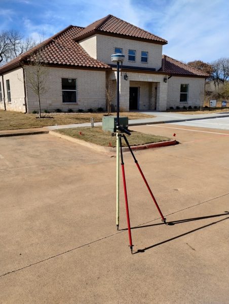
Land surveying is the science of measuring, mapping, and legally defining a property’s physical characteristics. Consequently, a licensed landscape surveyor uses field measurements and historical deed research to establish exact boundaries. They also utilize modern geospatial technology to document every critical detail in a legally binding form.
Furthermore, Texas law requires a Registered Professional Land Surveyor (RPLS) to perform and seal all boundary surveys. As a professional landscape surveyor, these experts must follow the rules of the Texas Board of Professional Engineers and Land Surveyors (TBPELS). DMC Henry operates fully within this framework. As a result, we deliver comprehensive surveys that satisfy title companies, lenders, and courts across DFW and North Texas.
Why North Texas Is a Unique Landscape Surveyor Environment
The DFW Metroplex presents unique surveying challenges. Specifically, these factors are fundamental to delivering reliable results in North Texas:
- Rapid Suburban Expansion — Collin, Denton, Tarrant, and Dallas counties are growing fast. Because of this, older surveys from the 1990s may be outdated. They often lack recent subdivisions, road extensions, or utility changes.
- Expansive Clay Soils — Vertisol soils are common to the DFW “Blackland Prairie.” These soils swell and shrink seasonally. Consequently, this movement can displace older iron pin monuments. A landscape surveyor must often perform resurveys to find original positions.
- Floodplain Complexity — FEMA Flood Insurance Rate Maps (FIRMs) affect the Trinity River watershed. Therefore, surveyors need current knowledge of LOMR/LOMA amendments. This expertise ensures they can accurately certify flood zone status on a survey.
- Easement Density — DFW has a massive infrastructure. As a result, most urban parcels carry multiple utility easements. Comprehensive research is a vital step for any landscape surveyor in this region.
DMC Henry – Your Local Landscape Surveyor Authority
As a licensed professional surveyor, we carry deep working knowledge of county deed records across Dallas, Tarrant, Collin, Denton, Rockwall, Parker, and Ellis counties. We do not treat DFW as a generic market; every survey we deliver is grounded in the specific legal history and physical conditions of that unique parcel, ensuring you have the professional oversight only an experienced landscape surveyor can provide.
Common Survey Types in DFW & North Texas
Not all surveys are the same. The specific type of survey required depends on the nature of the transaction, the intended use of the property, and what lenders, title companies, or municipalities require. Below is a breakdown of the specialized surveys most relevant to owners, investors, and developers operating across our landscape surveyor service areas in DFW & North Texas.

A Closer Look at the Most Frequently Requested Surveys
Boundary Survey
A boundary survey establishes or re-establishes the legal corners of a parcel. This process relies on recorded deeds, prior plats, and physical evidence found in the field. Additionally, the landscape surveyor researches the chain of title and locates existing monuments like iron pins or concrete caps. They also reconcile any discrepancies. If monuments are missing, the surveyor places new ones. Importantly, corner monuments are legal reference points in Texas. Removing them is a criminal offense under Texas Penal Code Section 32.47.
Furthermore, boundary surveys in DFW frequently uncover fence encroachments. They may also reveal informal driveway agreements that have become prescriptive easement issues. In fact, surveys often find remnant alley dedications from mid-century plats. These facts either protect or expose a property owner. Therefore, a professional landscape surveyor must document them in full.
ALTA/NSPS Land Title Survey
The ALTA/NSPS standard is the most comprehensive land survey available in the United States. Typically, commercial real estate transactions require this specific level of detail. These surveys follow a uniform national standard. Moreover, an ALTA survey goes far beyond a standard boundary survey. It documents improvements, easements, and encroachments. It also includes utilities and zoning setbacks based on “Table A” optional items.
Furthermore, Texas has additional unique requirements for these surveys. Texas title policies often lack standard zoning endorsements. Consequently, the square footage of improvements is vital for commercial assets. The DMC Henry team understands these Texas-specific ALTA nuances. We coordinate directly with title underwriters to ensure the survey clears all title exceptions.
Topographic Survey
A topographic survey captures the three-dimensional shape of a site. Specifically, it maps existing grades, contour lines, and drainage features. This data serves as the foundation for civil engineering design. For example, it is essential for site plans, grading plans, and drainage studies.
Additionally, a high-resolution topographic survey is a necessity for DFW developers. This is especially true when working with Vertisol soils or FEMA Flood Hazard Areas. In fact, it is usually the first deliverable in the project lifecycle. By hiring an experienced landscape surveyor, you ensure your project starts with accurate elevation data.
Why Land Surveys Matter – Property Rights & Investment Protection
A land survey is more than a formality. It is a legal document that defines your property rights. In the DFW real estate market, land values are high. Therefore, an inaccurate survey can lead to costly mistakes.
Protecting Ownership Under Texas Law
Texas property law can be complex. Specifically, certain legal rules can change where your boundary actually sits. A professional landscape surveyor identifies these risks before you close a deal:
- Boundary Disputes — Sometimes, neighbors treat an old fence or ditch as the boundary line. Over time, Texas courts may recognize that fence as the legal limit. A survey finds these risks early.
- Property Use Rights — If someone uses a part of your land for 10 years or more, they might gain a legal right to keep using it. Consequently, a survey documents these patterns to protect your investment.
- Written Agreements — Neighbors can legally agree on a boundary line if the true line is unclear. However, these agreements are hard to enforce without a clear survey.
- Seller Disclosures — Texas sellers must disclose known survey issues. Because of this, a pre-listing survey by a landscape surveyor helps satisfy legal requirements and prevents future lawsuits.
Survey Data as an Asset – Not Just a Closing Requirement
Smart investors in North Texas treat survey data as a valuable tool. A high-quality survey helps you understand lot sizes and utility costs. Additionally, it helps you calculate grading needs before you buy. These details directly affect the price you should pay for a property.
Likewise, an ALTA survey creates a strong baseline for your records. It protects you against future claims and makes selling the property easier later on. Furthermore, we work with many investors who use surveys to gain a competitive advantage. They include these documents in their standard due diligence.